Ralph Danquah-Acquah, a member of our RegenPGC Graduate Education Community, shares his research in this guest post, which previously appeared on LinkedIn (July 2026).
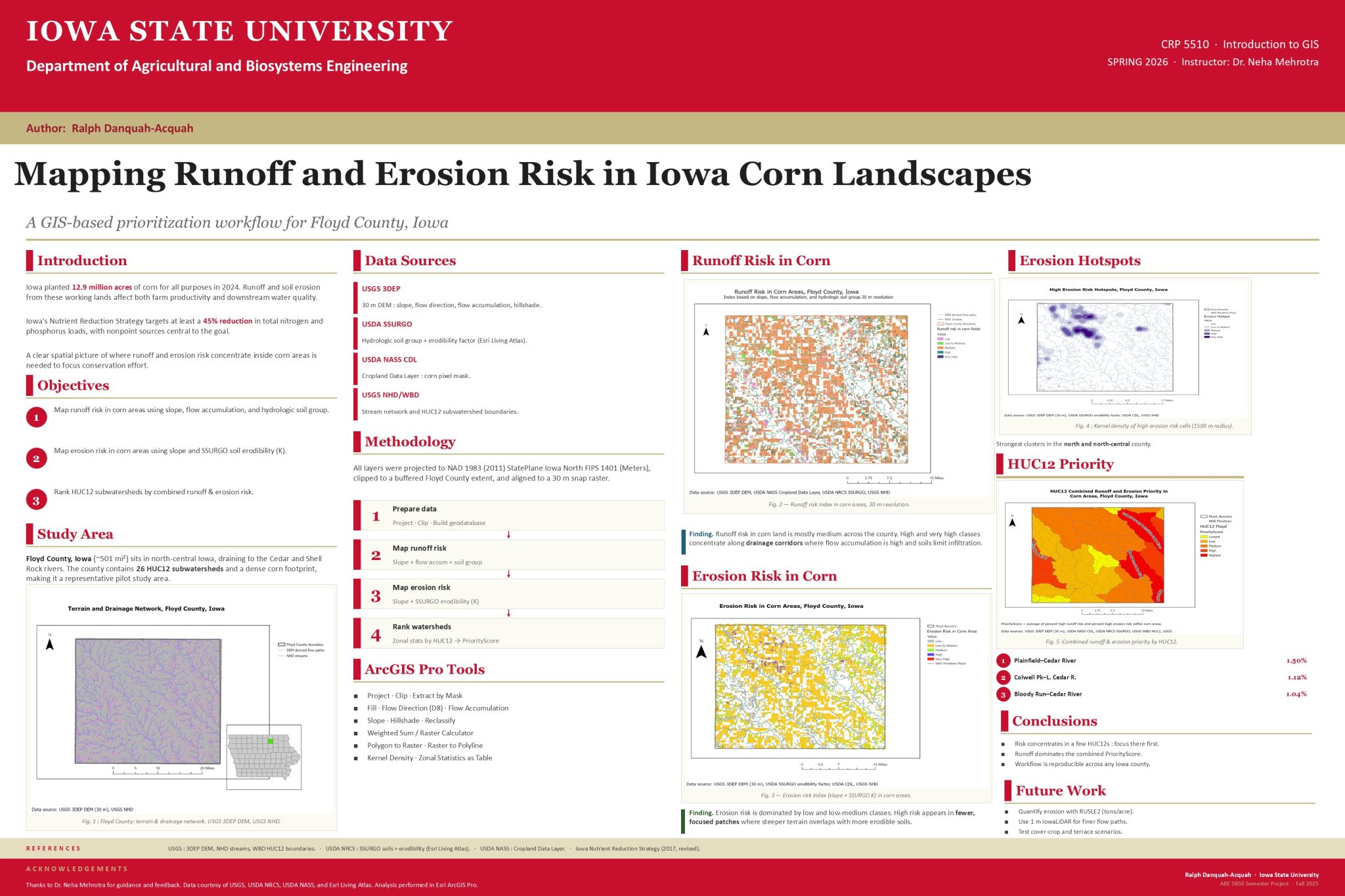
I completed my CRP 5510 GIS final project at Iowa State University, where I developed a GIS-based workflow to map runoff and erosion risk in corn landscapes in Floyd County, Iowa.
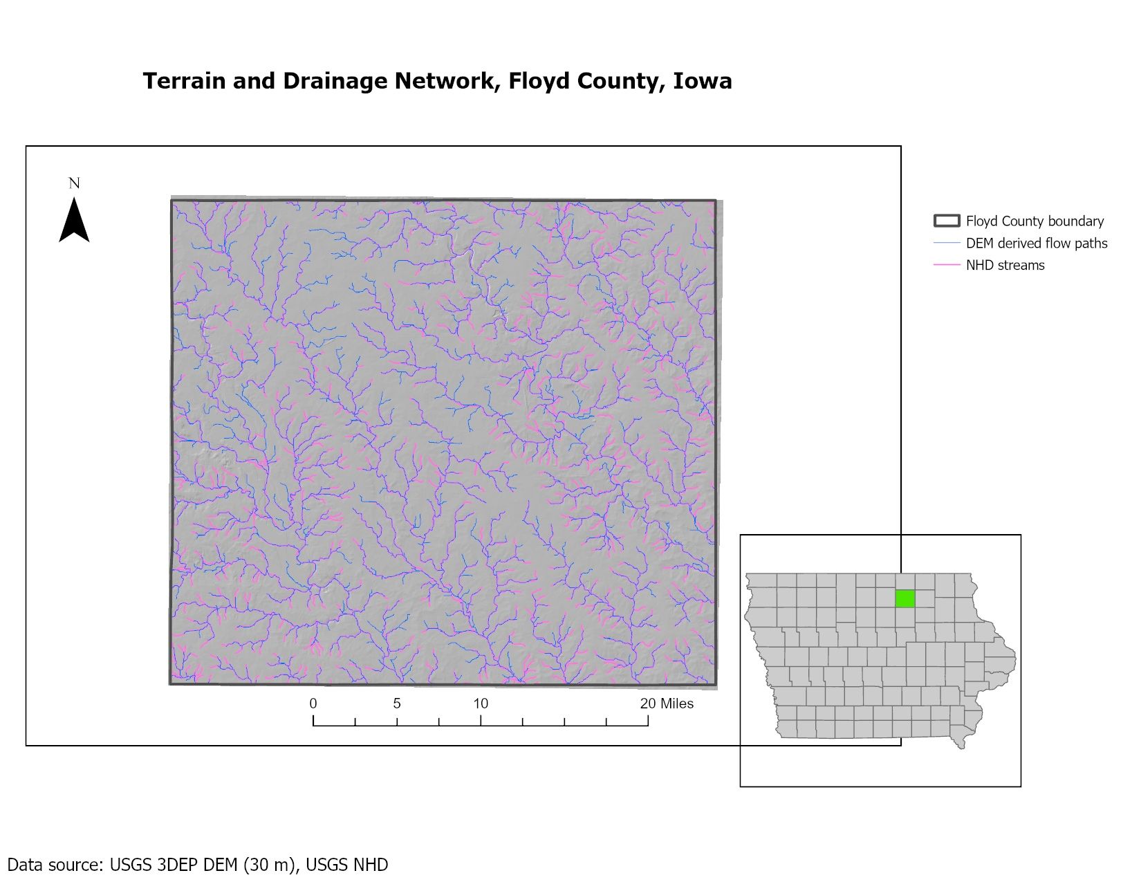
The motivation for this project came directly from my ongoing work with the RegenPGC project. My ALMANAC simulation work is connected to the Iowa State University Northeast Research and Demonstration Farm, and since that research location is in Floyd County, I chose Floyd County as the study area for this GIS project.
RegenPGC is exploring how perennial groundcover systems can help make corn production more resilient by reducing runoff, erosion, and other environmental losses. That made me think beyond the field scale and ask a broader spatial question:
If runoff and erosion are major concerns in corn systems, which places should be targeted first?
That question shaped the direction of my project. Instead of only looking at whether a conservation practice can reduce runoff and erosion, I wanted to explore where conservation practices may be most needed across the surrounding agricultural landscape.
The project focused on three main questions:
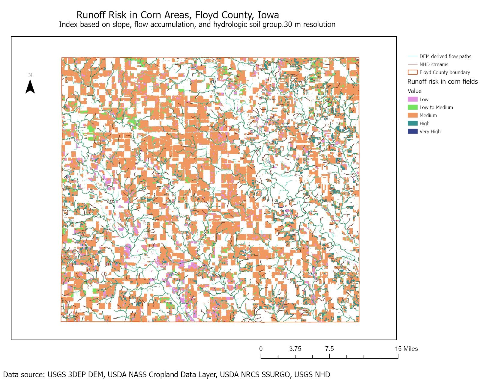
- Where is runoff risk highest in corn areas?
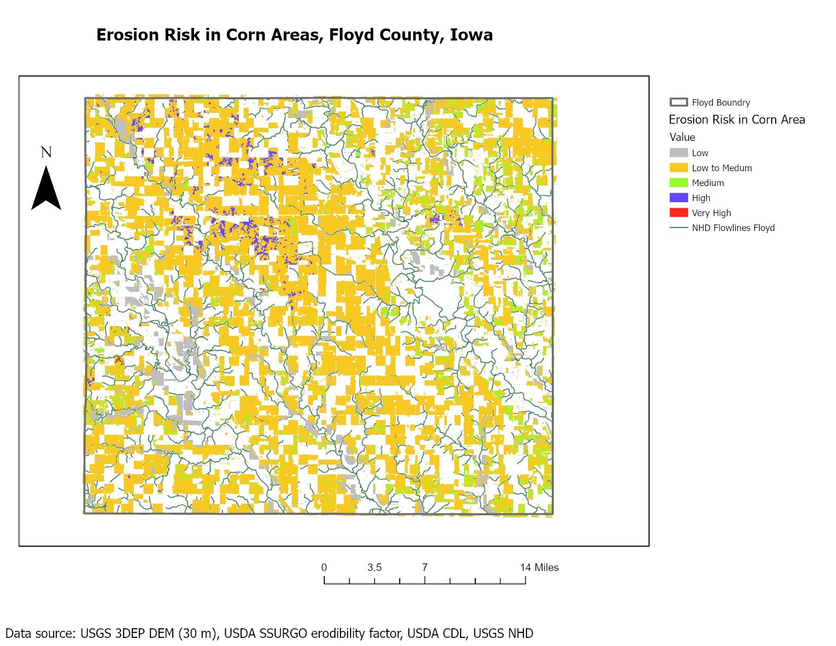
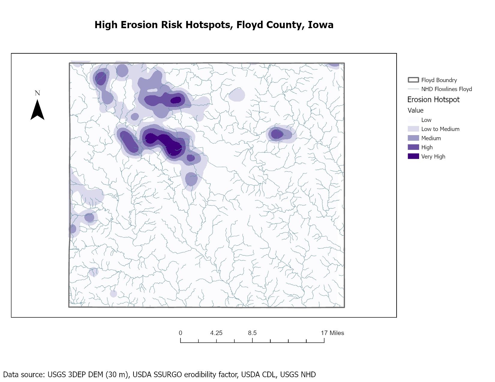
- Where is erosion risk highest in corn areas?
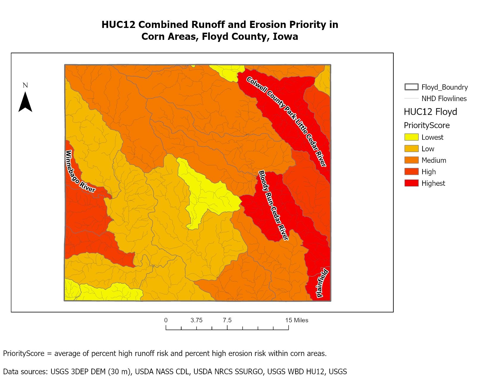
- Which HUC12 subwatersheds contain the largest risk and high-risk corn land?
Using ArcGIS Pro, I worked with open geospatial datasets including USGS 3DEP DEM, USDA SSURGO soils, USDA NASS Cropland Data Layer, USGS NHD flowlines, and WBD HUC12 boundaries. I created runoff and erosion risk indices, mapped erosion hotspots, and summarized high-risk corn areas by HUC12 to develop a combined priority score.
One key finding was that runoff risk was more widespread than erosion risk across corn areas, while erosion risk appeared in more focused patches and hotspot clusters. The final HUC12 priority map helped identify subwatersheds where field verification and conservation planning could begin first.
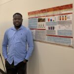
See the visual in these six poster images:
- Poster 1. Mapping Runoff and Erosion Risk in Iowa Corn Landscapes – https://www.regenpgc.org/wp-content/uploads/2026/07/Ralph-1.jpegPoster 2. Terrain and Drainage Network, Floyd County, IA – https://www.regenpgc.org/wp-content/uploads/2026/07/Ralph-2.jpegPoster 3. HUC12 Combined Runoff and Erosion Priority in Corn Areas, Floyd County, IA – https://www.regenpgc.org/wp-content/uploads/2026/07/Ralph-3.jpegPoster 4. Erosion Risk in Corn Areas, Floyd County, IA – https://www.regenpgc.org/wp-content/uploads/2026/07/Ralph-4.jpegPoster 5. High Erosion Risk Hotspots, Floyd County, IA – https://www.regenpgc.org/wp-content/uploads/2026/07/Ralph-5.jpegPoster 6. Runoff Risk in Corn Areas, Floyd County, IA – https://www.regenpgc.org/wp-content/uploads/2026/07/Ralph-6.jpeg